

Disability history is everywhere.
REPAIR strives to highlight place-based histories that have been neglected in our understanding of U.S. disability history, places that tell unexpected stories about disabled people’s lives and experiences, and places that clearly illuminate disabled people’s ongoing resistance to ableism.
This map isn’t comprehensive. It couldn’t possibly ever be “complete,” because disability histories are embedded in every square mile of the U.S. As we develop new case studies, they will be added to this map.
Navigating the Map
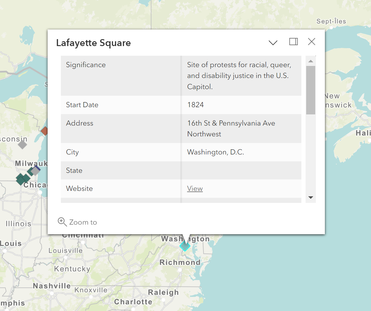
When you click on the icon that marks each mapped site, a pop-up will appear that features a brief summary of the place. The summary includes:
A statement of significance, explaining why the site is important
The "start date,” indicating when the place was constructed
The site’s address, city, state, and zip code
The place’s website (if one exists)
The place’s case study (if one exists)
The site’s building status (if it is still standing or if it has been demolished)
The site’s current use
A link to view an image of the place (that will open in a new tab)
A link to a relevant citation about the place (that will open in a new tab)
A link to the site’s formal historic designation paperwork (if applicable)
An indicator of whether the site is a National Historic Landmark
An indicator of whether the site is listed on the National Register of Historic Places
The top three interpretive themes REPAIR sees the place as addressing
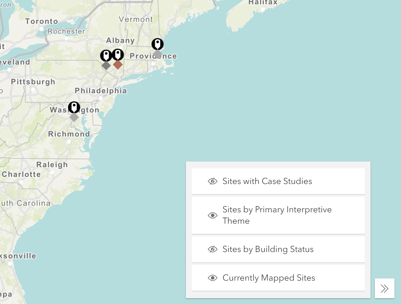
The mapped places can be filtered using the box on the lower right side of the screen. To filter the sites, click the eye icon to the left of the category you want to access. You can sort to show
Only sites with case studies
Sites by their primary interpretive themes
Sites by building status
All of the currently mapped sites.
About the Map
Putting place-based disability history on the map - literally and figuratively - is core to REPAIR’s mission.
REPAIR emphasizes how meaningful it is to pause, reflect, and learn about where we are, where we’ve been, and who has occupied places we’ve never visited.
REPAIR’s map features case studies of disability history sites across the United States. The map isn’t encyclopedic. Total comprehensiveness was never REPAIR’s goal. Our goals for the map include:
Provoking curiosity about disability histories
Providing a sense of what is possible when we look for disability stories in familiar and unfamiliar places
Modeling a type of intersectional interpretation that could be useful to others
Bringing attention to underrecognized sites
Raising awareness of sites’ ongoing historic preservation efforts
Why Did REPAIR Build a Digital Map?
StoryMaps can make place-based history accessible without demanding travel to a physical site. Particularly in the midst of a pandemic that makes travel a calculated risk, digital place-based interpretation provides COVID-safe options for sharing public history.
We were excited by the ability to include multimedia content in our StoryMap case studies. Being able to include text, audio, photography, videos, internet links, and more mattered to us as we thought about how to make these histories vivid.
Digital mapping can fill holes left by traditional historic preservation methods. For example, places that no longer exist in the built environment - that have been torn down or fallen victim to neglect - can still be commemorated and interpreted via StoryMaps.

Case Studies
The featured map compiles all of REPAIR’s case studies. It is also possible to review the full catalog of case studies by clicking the button below!